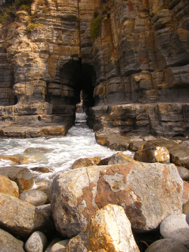
This daywalk will take you to Cape Raoul, to see the amazing Tunnel Bay, where the ocean carved a natural tunnel in the cliffs, and to Shipstern Bluff, a surfers spot hosting one of the largest and most dangerous waves of the world. And you can see that from the shore. Just stay way clear of the water if you don’t want to get wet.
Access
- Car park at the end of Stormlea Rd, after 9 km of a well maintained dirt road. 8 km west of Port Arthur. 43 11 42 S,147 46 38 E
- Public transport: none, the place is quite remote.
- Fee : the track is in the Tasman National Park, so park entry fees should apply but we didn’t see anything about it, there’s no way to pay at the trail head, and the car park is not even in the National Park.
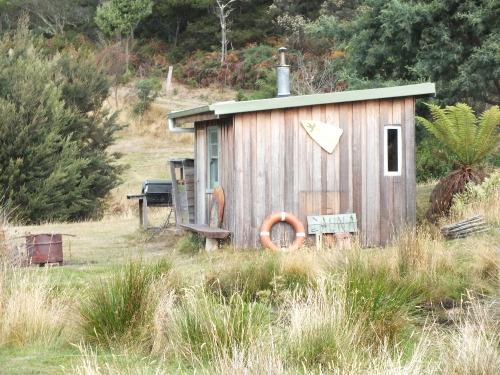
- Facilities : none on the track or at the car park. But just beside the car park is the Raoul Bay Retreat, providing accommodation, cheap camping, pit toilets and incredibly, a true swedish sauna. Yes one where you have to light a fire. Amazing. You can use the toilets and the sauna for a donation. If you are lucky you might meet Andy, the owner of the retreat.
Walk
- 12.5 km return, allow 5 hours
- 9 km / 4 hours return if you skip the detours to Raoul Bay Lookout and to Shipstern Bluff
Be careful to follow the signed track, as there is an old walking track that you are not supposed to take as it passes through private property.
From the car park take the walking track, and follow the markers. You will get at a gate, do not cross it, instead continue on the track, to the right. When you get at the intersection between the Tunnel Bay track and the Cape Raoul track, head on the left in the direction of Cape Raoul. Stop after about 600 meters, from there you will get amazing views of Cape Raoul and Raoul Bay. From there you can either follow this guide and go back to the intersection or the “60 Great Short Walks in Tasmania” brochure (see "Useful resources") that describes the 7 kilometers walk (one way, allow 5 hours return) to the end of Cape Raoul.
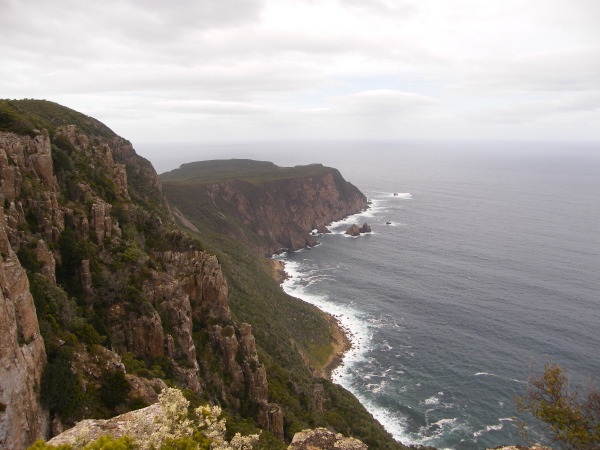
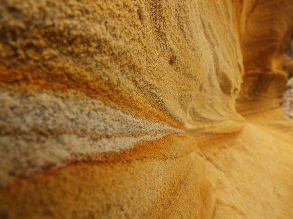
After the lookout come back to the intersection and this time take the Tunnel Bay track. You are now in for some climbing in the dense eucalyptus forest. On the way don’t miss some small but beautiful sand cliffs. If you didn’t go to Maria Island yet, this is a bit like the cliffs you might see there. Except the color and the size are completely different.
After going down at some point you’ll meet a 4WD track. On the left it leads to Shipstern Bluff, and on the right to Tunnel Bay. Take the right for now, we’ll leave the Bluff for later. The track goes steeply down to the rocky beach of Tunnel Bay. The Tunnel is to the right of the beach.
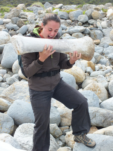
And there if you are lucky you might stumble upon some gigantic whale bones. But there’s nothing left to eat. We tried.
From the beach take back a 4WD track (there’s two of them, they both join uphill) and climb back up. You may now take the Shipstern Bluff track if you are not too tired (2 km return). The track goes down steeply and at the bottom you’ll have to scramble in the rocks to get a good spot at watching crazy surfers risking their lives in the gigantic wave.
Climb back up and retrace your steps to the carpark. You can now enjoy an awesome Finnish firewood Sauna, that’s what I call the good way to end a day walk. Don’t forget to donate something so that this place stays as amazing as it is.
Useful resources
- This walk is partly described in 40 Great Walks by Tyrone Thomas and Andrew Close
- The Bush Sauna
- Hiking South East Tasmania: Shipstern Bluff and Tunnel Bay
- TASTrails: Shipstern Bluff
- 60 Great Short Walks in Tasmania: Cape Raoul
- Climbing routes at Cape Raoul