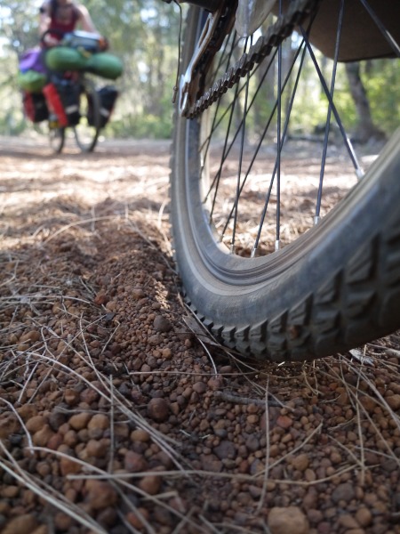
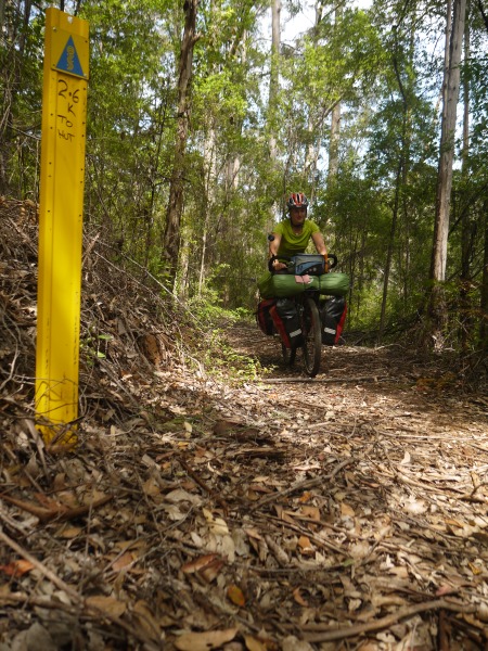
The Munda Biddi Trail is a great bike experience, with easy access to Albany by bus. It does have huts and shelters, and there is plenty of stuff to see along the track. We took two months to ride the trail, but we stopped to hike some parts of the Bibbulmun, wander in the Nuyts wilderness area and also went off-track to Busselton and hike the Cape to Cape! So you can definitely do it in much less, but we took the time and enjoyed the place as much as we could. There’s no hurry to end an adventure after all. I would advise to plan for a month if you plan to stop and do some sightseeing and hiking, but if you are short on time I would advise to plan for 15-20 days at least, unless you are a cycling machine.
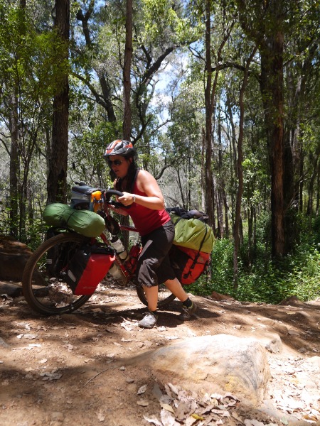
These are more or less my raw track notes when cycling the trail in October and November 2015. So please keep in mind that stuff may have changed, fires may have burnt shelters, rivers may be dry, and shops may have closed. The description is done South to North, from Albany to Perth.
Albany to Denmark
Plenty of shopping in Albany : Coles, Woolworths and IGA supermarkets. KMart store. 3 op shops.
Free campsite at cosy corner east (6.5 km detour from the trail) and Torbay Inlet, but supposed to become paying campsites in summer 2015. Water at cosy corner west.
Plenty of free camping spots on Keith Rd, next to the Hay River.
Shelters with camping possible along the Denmark-Normalup Heritage trail before denmark, all of them in a nice setting near the beach, but with a few steps to get to. The first one (actually the fourth as they are counted from Denmark) is 5.5 kms before Denmark. Some of them have a roof that is not waterproof at all, so consider that if you are looking for a shelter from the rain...
Denmark to Walpole
Denmark has a large Supa IGA supermarket and a small IGA Xpress (more expensive, go to the Supa IGA instead, it’s just 200m behind).
Jinung Beigabup hut is 43 km from Denmark on the Munda Biddi, or 15 km if you take a shortcut via Scotsdale Rd for 8k, turn right on to Mt Lindesay Rd for less than a km and join the Munda Biddi on the left for the last 4k’s of nice riding in the forest. The last km is uphill, partly in sand, be prepared to push a bit. Nice hut located among the trees, though the forest was recently burned sadly. Telstra and optus coverage.
The Bibbulmun also has a shelter with sleeping platform and toilets, 600 meters from the Munda Biddi, along a management track up the sealed road from Greens pool, on top of Tower Hill. But the track is sandy and very steep, and sleeping space has to be left in priority for Bibbulmun walkers (and Bibb huts are much smaller than Munda Biddi huts). But still an option if caught in bad weather.
Booner mundak shelter was closed because of prescribed burning at the time of our visit.
Tree top walk is getting quite expensive. $19 in 2015, $12.50 in 2013 and $6 in 2005... Not worth it in my opinion. But nice short walk (free) on the ground under the giant trees.
You can get away from the Munda Biddi a bit and climb on dirt roads to the Giant Tingle Tree (toilets, water tank), a nice place to visit.
Walpole
Walpole has a small IGA and a minimart, a few eating options and accomodation, including a nice YHA.
Walking on the Bibbulmun from Peaceful Bay to Walpole: hitchhike to Peaceful Bay (or car shuttle, or take the bus to Bow Bridge and walk 8km). 4 days, 62 km, medium (easy walking).
Nuyts wilderness: 14 km return to Thompson cove campsite, easy, nice. start from Tinglewood rd or Mt Clare carpark (adds 2k one way, or 4k return). After the suspended bridge over the Deep river, there is a shelter 200m further (bench, old Nyuts wilderness trailhead). Then nice gentle walking on the Bibbulmun for 3 km, continuing on an old vehicle track. At the boot cleaning station take left on the vehicle track, leaving the Bibbulmun. 3 km later a sign stating “Thompson Cove” leads on the left to the Peppermints campsite, 100 meters from the main track. This is the main campsite, nice and sheltered, with a running spring not far. From the campsite track continue on the right to Thompson cove (15 minutes walk), following the blue ribbons on an undulating track, cleared a ffew years ago. To go to Mt Hopkins, at the bottom of the campsite track (descending from the main track) take the track to the left, cross the river on a small bridge to another 2 or 3 cleared tent sites, and straight from the bridge there is a track ascending to the right in the swordgrass, follow it to the top and try to follow it up to the boot cleaning station at the foot of Mt Hopkins (2 hrs, 3 km return), or help yourself with the GPS track. Don’t take the track that goes steeply down the gully from the middle of the upper campsite, it joins up but it’s just easier to take the real track. To go to Aldridge cove (1 hr return from the campsite) you just have to go back to the main track (old vehicle track) and follow it to the end, then keep close to the right of the rocks up to the nice secluded beach. There is no good sheltered campsites at either Thompson cove beach or Aldridge cove, only the beach.
Walpole to Northcliffe
The trail to the first hut is mostly unsealed forest roads, not really interesting. A few patches of sand but mostly gravel.
Kwokralup Beela hut is quite nice (large), with a 400 meters walking track to get to a nice swimming spot on the Beela river.
The track ascends a good part of the way to Fernhook falls, then it is a long descent, with nice single track. The trail goes to a seasonal crossing, but the detour through Fernhook falls is nice and shorter, and there is a natural pool to swim. And a small campground with two 2 persons huts ($7.50 pp), gas bbq and water tanks. So why bother with the crossing?
After fernhook falls it is a combination of forest roads and single tracks through recently burnt forest, no shade, quite boring and there are a lot of trees and branches on the track, making the progress slow. There is a missing bridge requiring some equilibrium just a few kms before crossing the highway. Some nice section in heathlands.
Yirra Kartta hut (small size) has been burnt in february 2015 and is officially closed but it still can be used as it is still standing strong, only the transparent panels in the walls have disappeared, along with the gutters and the toilet septic tank. But the roof is still there, the tables and sleeping platforms too. Still is better and safer than pitching your tent between unstable burnt trees... There is walking track leading up the massive boulder next to camp. Great views and good Telstra phone reception from the top.
Betweem Yirra Kartta and Boorara tree there is a short section of single track and then it’s a long distance of forest gravel roads, going up and down continuously. Boorara Tree offers a nice stop for lunch or free campsite for the night with the toilets and picnic table. When it’s too hot a 2.5 km track leads from there to the Lane Poole Falls (named after Charles Lane Pool), nice spot where you can bathe in the shallow water at the base of the falls. From Boorara Tree there is 16 km to Northcliffe along the nice Boorara rd if you want to skip the last meanders of the Munda Biddi that follows the local MTB trail.
Northcliffe
There is a good but expensive general store, and a local organic co-op (Karri country good foods) which is cheaper but have less choice and is only open in the mornings. Public toilets and drinking water at the main intersection. Small caravan park.
Northcliffe to Pemberton
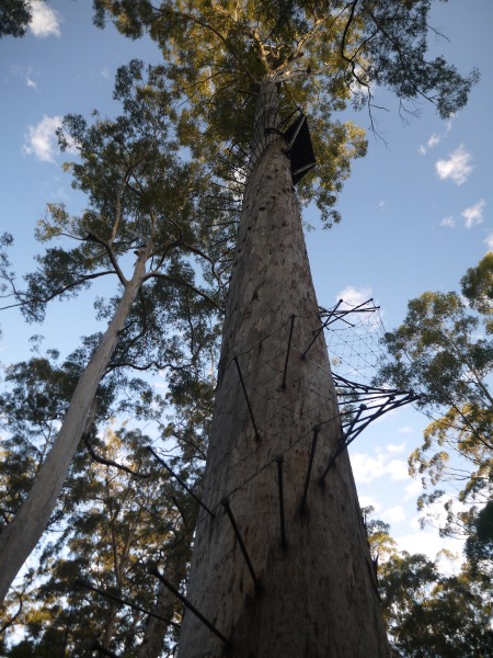
Skipped by going on the Northcliffe to pemberton rd, stopping at Dave Evans bicentennial tree for a climb of the tree. Toilets and shelter at the carpark. Good option for camping.
Pemberton
Has a good IGA store, a post office and a liquor store. Small museum in the visitor centre. Accomodation in the YHA is not welcoming at all, as the main YHA building is full of drunk people listening to loud music, but if you can skip on the cannabis smell, the reception might be open or the manager willing to answer your phone call, you might have the privilege to pay $33 (non members) for a bed in a 6 bed dorm in a nice cottage further on in the town, far from the seasoners. But there’s a catch: the cottage only has one toilet and shower for 10 people.
Pemberton to Manjimup
skipped by going along the karri forest explorer to Big Brook Dam (worth the detour) and straight to the Karta Burnu hut.
Manjimup
Large town with coles, woolworths, The Reject shop, post office and outdoor/cycling store.
Manjimup to Jarrahwood
Manjimup to Karta Burnu hut is 23 km along mainly forest roads and old form, it is slightly downhill. The first kilometers on the rail trail from Deanmill to Manjimup are quick and easy but be careful, locals on motorbikes also like to take this trail.
Karta Burnu is one of the best huts of the Munda Biddi, with great views, placed on top of a grassy hill. Very scenic and well worth spending a rest day there.
Karta Burnu to One Tree Bridge (4.5 km) is downhill through switchbacks on a nice single track, great fun. The new suspension bridge is also quite nice. One tree bridge has toilets, and a bit further on picnic toilets on the banks of a nice natural swimming pool. Just after One Tree Bridge there is a campsite, Greens Island, but no sign leads you there, you have to follow the map.
One tree bridge to Donnelly River is mainly on single tracks through the forest, really nice, apart from the couple trees on the track forcing you to dismount, unload and carry the bike over the fallen tree.
Donnelly River Village
This tourist village is nice, but there is not a lot to do here. The historic mill, once a museum, is now slowly falling in ruins. The general store is also the only store, and provides some takeaway food or cafe meals, but don’t expect to be able to resupply here. There is a free shelter to sleep near the school, it is basic but will provide good shelter from wind an rain and has tables and a few chairs and benches. Public toilets and water tap are just 50 meters away. You can also pay $25 pp for a bed in a dorm in the old school building near the shelter. Or pay $5 per person for a shower. Ask at the general store. Telstra reception is patchy at the shelter, better when you climb to the highest place in the village behind the school.
Donnelly River Village to Nannup
From Donnelly River to Willow Springs (12 km) it is mostly nice single track with some short pea gravel sections.
Willow Springs is a nice campground, free, with no toilets, only two picnic tables and fire pits.
After Willow Springs you have to endure a long stretch of gravel road in the forest but don’t desper, soon you’ll meet a bitumen road on your right and after a short climb you will enjoy a long descent to the highway, then it is a short section of footpath to Nannup.
Nannup
Nannup has a small general store, and a couple of cafés and takeaways, if you have the chance to come here when they are open (that is rarely). There is also a caravan park. Free cold showers and power points at the public toilets after the caravan park. There used to be a bike repair stand at the Munda Biddi trailhead but it currently is broken. Phone reception in town.
Nannup to Jarrahwood
Just at the Munda biddi trailhead in Nannup you will have the choice to follow the Munda biddi trail which goes on the Sidings rail trail, or do the Old timberline trail which joins up with the Munda biddi at Cambray siding.
The second one is a bit longer, but it is much more fun. Unlike a classic rail trail this one does not follow the original rail line but meanders around it on mostly downhill, fun and fast single track. Plus there is three campsites on the way, the first two (Workmans pool and Barrabup pool) attract a fee of $7.50 per person and are along nice natural swimming pools. And the third one (Sleeper Hewers camp) is free, also has a beautiful natural swimming pool but also has a nice hut with four 2 persons platforms (that makes up to 8 people). Well worth the stay.
After the camp the trail has no single track sections, only classic rail trail to Cambray Siding, a large clearing (used to be a timber mill town) nice for camping but also popular with 4WDs and grey nomads. Here you rejoin the Munda biddi and the Sidings rail trail to Jarrahwood. It is mostly single track on pea gravel, with lots of old sleepers on the side of the track, there is even a picnic table built with rail sleepers a bit before Jarrahwood.
Jarrahwood
This small town has no shops, just public toilets, a shelter with Memoribilia photos and the Munda Biddi hut. The town also has a community house that you can rent for $20 per person (up to 9 people). It’s a old house and some of the beds are a bit too soft but it’s a nice place to stop. It has a good kitchen, hot shower, TV and a (free) washing machine. To get the key to the house you have to go see Helen or Mark at the last house before the Memoribilia display (when you come from nannup), it is the number 6. The community house is the nearest house to the bike shelter. The house is often fully booked for christmas holidays.
Jarrahwood to Donnybrook
This is a long uninteresting section, except for the few short single tracks. Most of the way is flattish with gravel or sand or both. Nice flat and fast sealed road at 12 km from Donnybrook, then it gets a bit better until you hit the soft gravel road to Donnybrook for the last 5k of riding.
Donnybrook
Medium townsite with a medium sized Supa IGA supermarket open 7 days 7am to 7pm, a couple of eating and sleeping options, a visitor centre and a fun kids park (behind the visitor centre). Toilets and water.
Donnybrook to Collie
To avoid riding on the same soft gravel road as the way in you can take the South Western Hwy for 4 km, avoids 6 km of riding. The Hwy is busy with cars and trucks but the Hwy has a good wide shoulder (gravel for 1k and then bitumen) to keep you safe. Just be careful with the trucks.
After crossing the Hwy you ride on the bitumen Hurst Rd. Nice fast road, few traffic, quiet and pleasant ride to Joshua Brook lake. Here there is a paved walking track and picnic tables. After the road becomes soft gravel, and as you turn onto Boyanup Ferguson Rd it begins to climb, still in soft gravel. Be careful as the area is popular with trail bikes. A bit further you reach Crooked Brook Forest, providing a good stop with toilets, sheltered tables, barbecues and a water tank. The brook itself only flows in winter. Still there is a pleasant short walk around the area.
From Crooked Brook Forest you cross the gravel road to join the Marri walk track for a few hundred meters of single track. Then you get on an easy going sealed road to Ferguson rd. There the track ascends on a forest road. But a nice and easier alternative is to take to the right on Ferguson rd and ride along Wellington Mill rd. This undulating bitumen rd will lead to the Wellington Mill township, though nowadays only a few houses are left. There are toilets and water there. Continue to the intersection and take left on Wellington Forest road, climbing steadily to Wellington Forest Discovery centre (toilets, water and shelter with benches, picnic tables). From the Wellington Mill intersection you can continue on the sealed road for approximately 1 km to Gnomesville, a roundabout with thousands of garden gnomes. After the Discovery centre the road is sealed to the intersection with Pile Rd, take left to rejoin the Munda Biddi which now descends on a technical forest track down to the Nglang Boodja hut, sheltered under the trees just above a bubbling stream. Quite a relaxing place.
From the hut you have to cycle uphill for 1 km to find the track and go down on a forest track full of ruts. Nice downhill. Ignore the single track on the left and take the bitumen road to the left, down to the bridge on Collie River. Following the Munda Biddi signs to the right leads to an old recreation area with toilets and a nice natural pool to swim. This is a nice free campsite, with tent sites on the old car park before the toilets or to the left of the track near the river after the toilets. It is a quiet (and free) alternative to Honeymoon Pool which is often filled with tourists and schools. If you continue on the Munda Biddi after the pool you will face a very challenging section. To avoid it, backtrack or take left after the bridge to Honeymoon Pool (camping $7.50 pp, toilets, water, gas bbq, swimming spot), follow the bitumen (soon gravel) road on a short steep ascent to meet back with the Munda Biddi. Take left and follow a nice single track downhill before the trail ascends steeply in switchbacks to the top of the hill. This is a very challenging climb.
On the top of the hill the single track goes down a bit, but you still have some climbing ahead of you.
Meet a forest road full of pea gravel (Windy Ridge rd) then take a single track with sand and pea gravel. Finally you reach Coalfields Rd, cross it and follow a nice gravel road in the middle of fields and cows, a welcome change after all this forest. You soon meet with the sealed Gastaldo Rd, take left. If you don’t want to go to Collie you can stay on Gastaldo Rd until you meet back with the Munda Biddi trail on your left under electric pylones, this is shortcut. If you do want to do the 40 km detour to Collie you just have to follow the trail to the 3 ways intersection, then head right (west).
Collie
Major town with Coles, Woolworths, hotels, a caravan park, etc. But nothing really interesting. Not worth the 40 km detour IMHO.