This is a nice day walk that will make you exercise with a tad more than 1,050 metres to climb and descend in the day, starting from sea level up to the summit of Kohukohunui at 688 metres. The main interest of this walk are the superb views you will get on the Firth of Thames, the Coromandel Peninsula, Auckland city and the Manukau Harbour. If the weather looks bad and you might get no views you can probably skip this one, as there’s 50% of wide, muddy, not too interesting tracks.
Access
This walk starts from the Waharau Regional Park visitor centre.
- Car: 1 hour 30 minutes drive from Auckland CBD.
- Bicycle: 4 hours ride (51 km, +430 meters climb) from Papakura train station, nice scenic road, slightly hilly.
- Public transport: none.
Facilities
- Toilets, shelter, picnic table and tap water at the visitor centre.
- Toilets, shelter, picnic table and rain water at the 1000 acres campsite, 1 hr 30 minutes to 2 hrs from the start.
- Hut, lookout platform and rain water tank at Trig K Hut, 2 hrs from 1000 acres campsite.
- Lookout platform and toilets at Adam’s lookout, 1 hour from Trig K Hut.
Walk
Start from the Waharau Regional Park visitor centre, or 500 metres further along the dirt road if the gate is open. Warning: the gate closes in the evening, at about 6pm in winter, if you have a doubt, park your car in front of the visitor centre instead to avoid being stranded.
Follow the red poles along the gravel road to a carpark and a gate where you will have to clean your shoes to protect the Kauri trees. Make sure to close the gate properly as there is sheep on the other side. After 200 meters the track goes to the right and you soon reach a gate and a stile to go over the fence. Continue to follow the red markers on the Waharau ridge track. This track is quite easy to follow, with good gravel, steps, and boardwalks, climbing more or less steeply. You reach a first lookout platform with a bench 30 minutes from the start, giving you a glimpse of the scenery you will see at the summit.
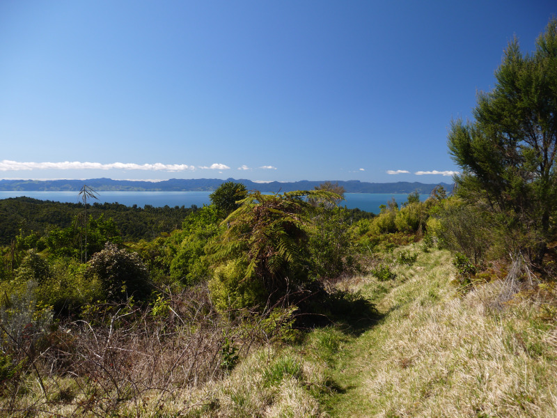
Continue along the red track and ignore side tracks. 30 minutes later you reach another lookout with a bench, at almost 300 meters of elevation. Continue the climb, and just before reaching 400 meters of elevation you reach an intersection. The Waharau Ridge track continues to the left, downhill, but you have to take right to the Kohukohunui Track. Two minutes later another intersection is reached, with the Mangatangi Ridge Track on the left, and the Kohukohunui Track to the right. Take left, the track is now large and muddy, almost a 4WD track, going downhill for 20 minutes. You now have to follow the orange arrow markers, no more red poles.
You then reach the 1000 Acre campsite, a good place to rest with shelter, toilets, tables and rainwater. This is not an ideal campsite, as it is far from being flat, but the shelter is quite nice. Shortly thereafter is the Mangatangi Stream that you will have to cross. It was easy to cross, about knee-deep in September 2016 (and cold), but it might be deeper and faster flowing after rain so be careful when crossing. 5 meters later there is another small tributary stream to cross too. But this is the only creek crossing of the tramp.
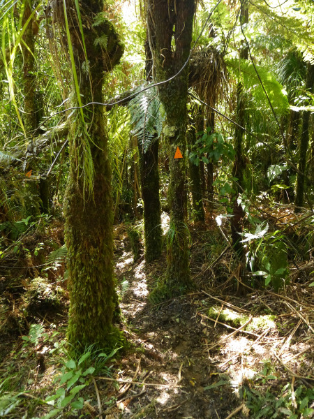
The track is now a much prettier and enjoyable narrow walking track, climbing through the bush, sometimes emerging among clearings that will give you some sunny moments (well if it’s sunny!). The track is going up and down, but mostly up, with some steep and slippery sections, this is why it is recommended to do this walk in this direction, it is easier going up than going down the steeper sections.
About two hours after the last intersection you will reach another junction, take right to Kohukohunui. 30 minutes later and some muddy sections you should reach the K Trig and the lookout platform, a good place to enjoy lunch with wonderful views all around, from the highest summit of the Auckland region.
Continue for less than 5 minutes to reach Trig K Hut, a small 4 person hut with 2 beds and 2 mattresses, a fireplace, a table, and a rainwater tank. This is also a good place for lunch in case the weather turned to rain!
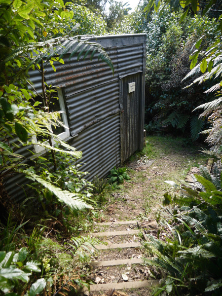
Follow the track, you will be greeted by some boardwalk and soon another junction with the Kohukohunui track, the boardwalk continuing to the left and you going to the right. The track is good, with nice mosses and lichens, slightly undulating, and soon reaching good views on grassy clearings. One hour later you reach Adam’s lookout, where a lookout platform will give you more good views around the area. 15 minutes down a wider old vehicle track is Adam’s lookout campsite: one of the worst official campsites I ever saw, small, damp, not even flat, and the toilets don’t even have a door anymore.
Follow the track down for 500 metres, take right on a nice narrow walking track when you reach the gate. Another 30 minutes and you join back with the Mangatangi track that you took earlier. From there five minutes of walking will take you to the Waharau ridge track, where you can take left on the track you came up for an easy one hour descent or take right for a longer 1 hr 40 minutes alternative return.