From the privacy of remote passes to the crowds of the main attractions of the Blue Mountains, this nice day-walk will be a great adventure ending with an easy stroll. A very nice hike for a hot day as you will be under the shade of trees near running streams much of the way.
Access
The Blue Mountains are extremely well served by train from Sydney, it is reasonably cheap and practical. Check the hours and rates on Transport NSW website. The trip from Sydney Central station takes a bit less than two hours and costs $12 to $15 return (depending if you ride off-peak or not). The cheapest option is to take the train on sundays, when it’s only $2.50 return.
- By train: take the train to Leura train station on the Blue Mountains line. Take the train back from Wentworth Falls station.
- By car: this is not a loop, using the train is better, but if you do have to take your car leave it in Leura near the Golf and catch the train back from Wentworth Falls, or do a loop walk by climbing back up Roberts Pass (see below).
Difficulty
This walk begins with a hard descent in Gladstone Pass. It is a gorgeous place, really beautiful and quiet. But it is steep, often wet and requires some rock scrambling as well as some shorts exposed sections of walking. There is also a 50 metres section of walking down steps carved in the rock face while holding a rope. Not a hard section but might be a bit scary as the rock is wet and slippery. But it’s doable and there are ropes in the scariest places which makes it less scary. After that it is mostly easy flat walking, except some rock scrambling when crossing streams. Avoiding wet and rainy days would be better, especially during heavy rains as streams will be harder or might get impossible to cross.
Finding the track down Gladstone Pass is sometimes a bit hard, so take your time to watch where the main track is, but you just have to follow the stream down, don’t go up that’s all. When you reach Lindeman Pass it will be easy to follow.
The track is partially muddy most of the year and there are leeches on Lindeman Pass, so take some repellent and long pants.
Track
Leave the train station and head down south to Leura Mall where all the shops are. Turn left (east) on Megalong Street where the entrance to Woolworths is. There are public toilets just in front of the shopping centre. Continue down Megalong Street all the way to the end and take right (south) on Gladstone Rd. After 600 metres take left on Fitzroy St and take the first road on the right (Watkins Rd). At the intersection turn left in direction of the Leura Golf Club. You reach it after approximately 40 minutes of walking in the streets.
Enter the Golf club to the right and after only 50 metres turn right on a small car park. You will see a 4WD track going down in the bush, follow it down and watch your left as you will soon see the sign to the start of the Gladstone Pass walking track, advising you shouldn’t proceed “unless accompanied by an experienced navigator”. Well you don’t have to use a compass to figure out if you are going up or down a mountain but I figure that the sign is mainly there to discourage tourists or golfers in flip-flops getting lost in the bush thinking they will just take a nice walking track on a Sunday stroll.
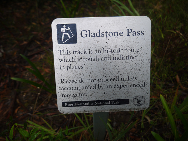
The walking track is easy and will take you to a large forest track. Walk down the forest track where another sign will try to discourage you from going this way. The track begins just after the sign. And this is where it begins to get harder. The track goes down steeply following the stream, and you will have to scramble down using your hands, roots, rocks and ropes at multiple times. This is not so hard as there are good foot and hand holds all the way but be careful as it is slippery and sometimes the walking track is exposed, passing just above cliff faces. The track is often muddy as well.
After some time you will reach the first crossing of the stream. On the other side there is a rope secured to the cliff face to help you go down a series of stairs along the exposed cliff face. You should avoid walking on the fallen tree trunk as it is really slippery. Hold on to the rope at all times as the fall down to the bottom of the gorge would definitely not be fun.
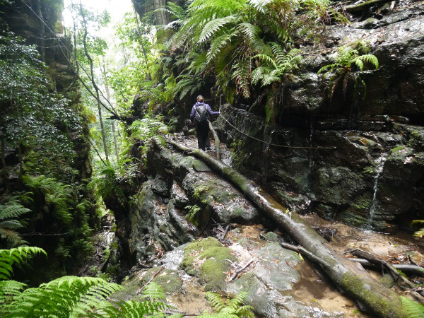
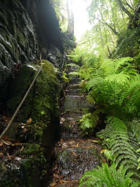
After this tricky but funny part the track meanders down the stream from left to right and crosses the creek multiple times, try to find the best place to go down, as sometimes there are multiple options and tracks. Sometimes you will see a ribbon or tape tied to a tree, an arrow or a square of white metal nailed to a tree to help you find the right way so look around.
After 1 to 1.5 hour of scrambling down you will reach a cairn marking the intersection with Lindeman Pass. Stop here, and look around, there will be a yellow metal arrow nailed to a tree where you did come from, a white square piece of metal nailed to a tree to the west (right when you descend down from Gladstone Pass), and yellow square piece of metal on a tree to the east (left when you descend). Don’t miss it as you might have trouble finding it again if you go down the wrong way.
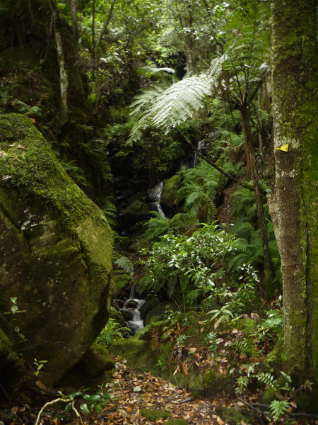
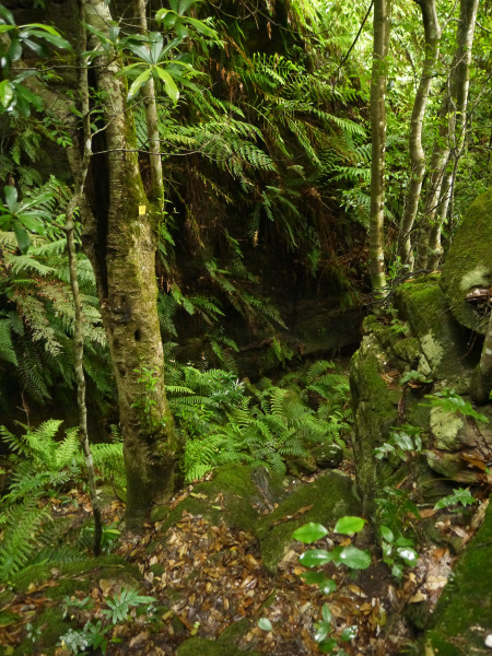
Follow the yellow square piece of metal to the left (south-east), after a short scramble down you will reach the Lindeman Pass track, which will be mostly flat, well defined and follows the bottom of the cliff face. Now the rest of the day will be much easier and safer, as the track is easy to follow. Just make sure to keep an eye when you are crossing a creek.
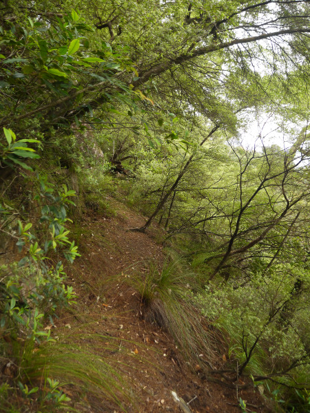
Lindeman Pass was built in 1911 at the initiative of Charles Lindeman to make a link between the popular National Pass at Wentworth Falls and the even more popular Federal Pass at Katoomba. Unfortunately the local businessmen of Katoomba pushed against the completion of the last 200 metres of the track. Helped by an anti-german sentiment before World War I, it resulted in the track never being completed or maintained after its construction. The track was neglected, mostly overgrown and almost forgotten for most of the following century, until locals and bushwalkers began doing some basic maintenance from the 1980s. Today it is easy to follow but there is still some tough parts, fortunately for you they are to the west of Gladstone Pass.
Not long after you left Gladstone Pass you will reach Lawton Creek. Before crossing it you might see a tree marked “Mine” with an arrow (and another arrow pointing to where you came from saying "Leura"), it is where you can scramble down to an old mine tunnel. It’s not really worth going down, as there’s not much to see except a small and partially submerged tunnel. But if you want to go head down the slope (carefully) for approximately 100 metres, keep an eye on the creek as there will be two large cairns on rocks. From here go right for 30 metres to another small cairn. 10 metres down from that cairn there is the mine tunnel.
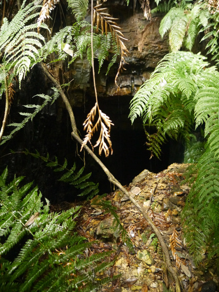
The Gladstone coal mine was opened in 1885 and closed the following year, with not much coal extracted. But it is the reason why the track down Gladstone Pass has steps cut in the rock walls, as it was the main access to the mine then. Other interesting facts includes the aerial tramway which was first erected here and then moved to Katoomba and the fact that the rails used here were later used to build handrails on the National Pass walking track (you will see them later).
Less than a kilometre later you will meet the intersection with Roberts Pass. If you want to cut short and back to Leura this is where you should head up. This pass is really nice too. But note that it is a steep hike up to Inquisition Point and it will be much easier to just climb up the stairs to Wentworth Falls in the Valley of the Waters.
You then continue on Lindeman Pass to the intersection of the Vera Falls track, followed by the one with Wentworth Pass and finally after crossing the creek below some falls you finally reach National Pass and its crowd of tourists walking with a selfie stick in one hand. Ah sweet civilisation!
From this point you can take left and climb out of the Valley of the Waters to the Conservation Hut Cafe (45 minutes) if you are short on time or take right and do a loop via National Pass and Under/Overcliff track (3-4 hours). National Pass is a wonderful track, but is really crowded on weekends, public and school holidays. Quite a shock after the solitude and quietness of Gladstone and Lindeman Pass. But still, if you don’t mind the crowd (or you are here on a quiet day) you should definitely do National Pass, as it is a very scenic walk carved in the middle of the cliff face over a century ago to attract tourists, and it definitely is very scenic with amazing views across the Jamison valley.
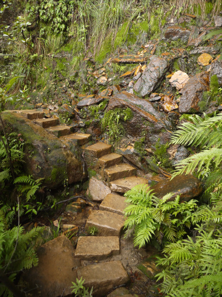
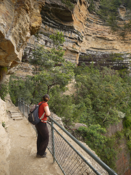
After crossing the creek at the bottom of the upper Wentworth Falls you will climb the giant staircase, an easy but long ascent to the top of the falls. It will be busy on tourist days but it is quite a feat.
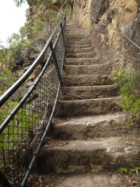
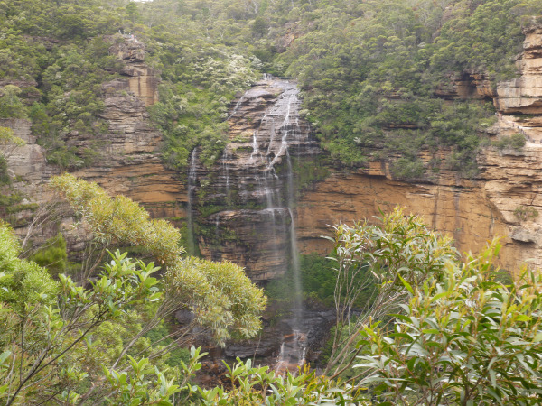
After crossing again the creek on top of the Wentworth Falls you have the option of leaving the track by going to the Wentworth Falls picnic area and walking to the train station, or continuing on the lesser known Under/Overcliff track back to the Conservation Hut. I strongly recommend this, as the track, although muddy and wet, is also really nice and peaceful, quite charming actually.
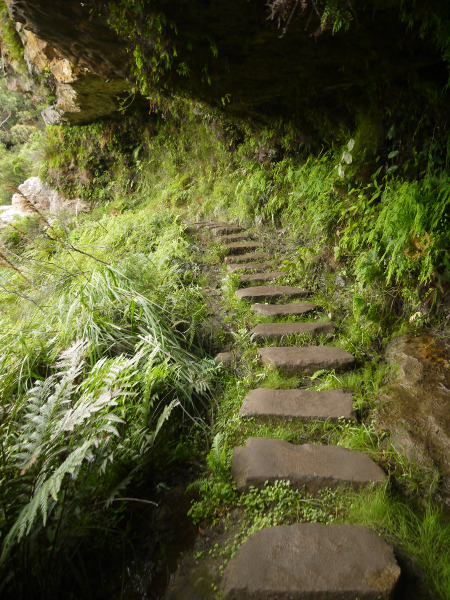
You will get multiple opportunities to leave the track and go back to civilisation along the way but it’s worth going at least to Den Fenella lookout, a 200 metres track carved in the rock that goes to a nice lookout giving wonderful views.
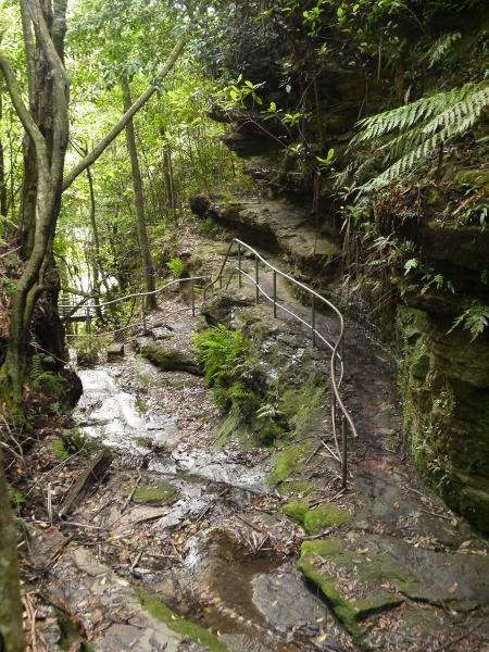
After the Den Fenella intersection there’s not much left to go to get to Conservation Hut Cafe.
To get back to the train station follow Fletcher Street up to Pritchard Street on the left. Then take the third right (Armstrong St), second left at the church (Falls Rd) and cut through Wilson Park to get to the Highway. You will find a safe crossing just in front of Station Street, which as the names shows, leads to the train station.
Recommendation
This walk is best done in the order shown (Leura to Wentworth Falls) as it begins with the hardest and longest part (Gladstone Pass), and gives you plenty of options to exit the valley and climb back to towns if you are short of time. And this way you can relax on easy flat paths before climbing the stairs back. Climbing Gladstone Pass would be hard after a long day of walking, and it will get dark very early inside the gorge. You don’t want to be left wandering in the gorge when it’s getting dark.
External references
- Gladstone / Lindeman / Roberts loop on EveryTrail
- Lindeman Pass on FatCanyoners.org
- Gladstone Pass trip report
- Lindeman Pass on JamisonProject.org
- The Blue Mountains Mystery Track: the Lindeman Pass: a History of the Jamison Valley, volume 1 by Jim Smith (1990)